Tuesday, September 12, 2006
NoDak: Nowherest
 On west. The rain lets up. US 2 continues its pace west past little towns and littler towns and empty towns.
North Dakota gets dissed by the mapmakers. A state 340 miles across and 211 top to bottom, it gets one page in Rand McNally - the same as 40 x 30 Rhode Island. Ohio, 220 miles in each direction, gets four pages. As a practical matter, this makes sense, because there aren't that many roads and towns to fit on the page. As a practical matter, this means that no matter how fast the miles are going by, the inches take forever.
At the rest area where I didn't sleep, I looked at the official state map. It had a list of all the towns in the state, and next to all the towns it had a number, and the numbers were so small it took me a minute to realize they really were the population, and not in thousands:
 Abercrombie, 296
Adams, 203
Alamo, 51
Alexander, 217
Alice, 56
Almont, 89
Alsen, 68
Ambrose, 23
Amenia, 89
Amidon, 26
... and so on. Amidon is the seat of Slope County, so it's printed in red.
 It's not just that there are small towns in North Dakota; there are small towns everywhere. The nearest town to where I grew up had a population listed at 200. It had a church, a grocery store, a little post office, a school until they closed it, and a pizza shop until it got busted for drug trafficking. And a cemetery, of course. So I know from small towns. But we always had Delaware, ten minutes away, and Columbus, half an hour south; no matter how nowhere Kilbourne was, it was on the periphery of somewhere.
There are about 150 towns listed on the North Dakota map, and I count 8 of them in the five digits, against 100 or so in the three digits or less.
 US 2 does take me to one of the big towns this morning, Minot, which is a university town and home of the state fair and a major crossroads in these parts. There's a railroad museum, closed 'til Monday, and an art museum, which is open but occupied by people setting up for a wedding party. There's a Starbucks, and another coffee place where the internet is free, and a decent sized mall, which I gather is the only mall this side of Grand Forks. It's not a bad place, but there's not much nonsense about it. It looks like a town where work is hard, and people might be suspicious of any sort of work that's not hard.
I keep going. The road sign reads "Kenmare 49; Williston 126." Kenmare, which is up US 52 and not on my route, checks in at a population of 1,081 - and it's the only town they can find to keep Williston company on the sign.
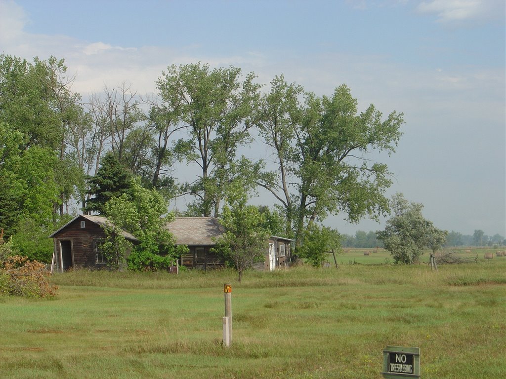
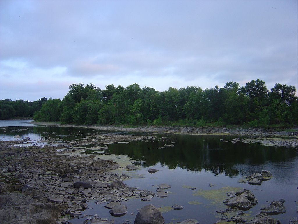
 I stop at a rest area to eat lunch. Prairie dogs watch me drive up. There's a man sitting in his car looking for someone to take his wheel so he can get to Minot; he's diabetic and found himself getting dizzy on the road. Somewhere west of there I turn down a gravel road so I can get to Lewis and Clark State Park, where I'm thinking I might camp.
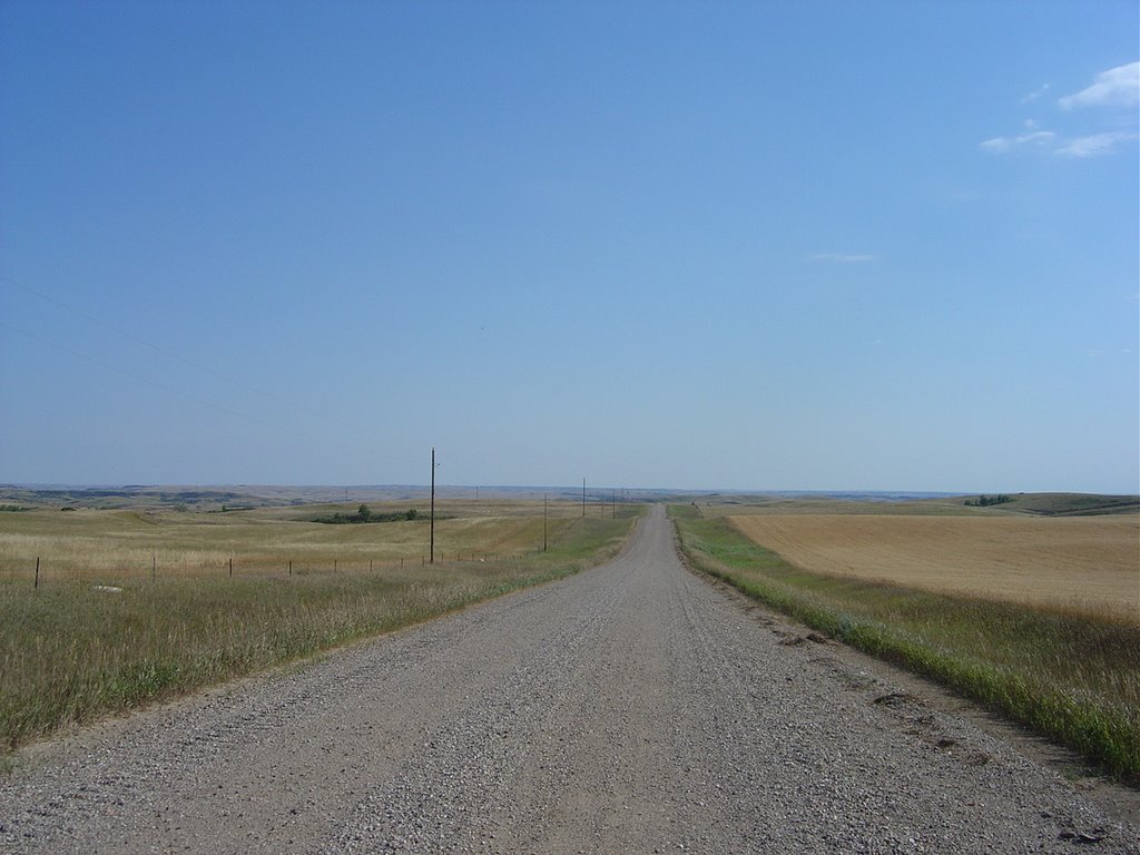
After a couple miles, I pull to the top of a rise. You can see for miles in any direction. There's no one in sight. There's no other road in sight. The only signs of human existence are a couple of oil wells and a barn or two and the gravel road. The wind is blowing. As far as I can tell, I'm the only person in the world.
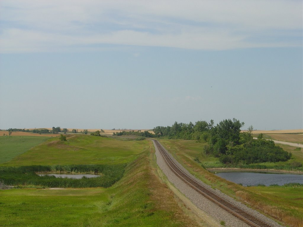
You might never go there, so this is what North Dakota looks like:


Friday, September 08, 2006
NoDak: Middlest
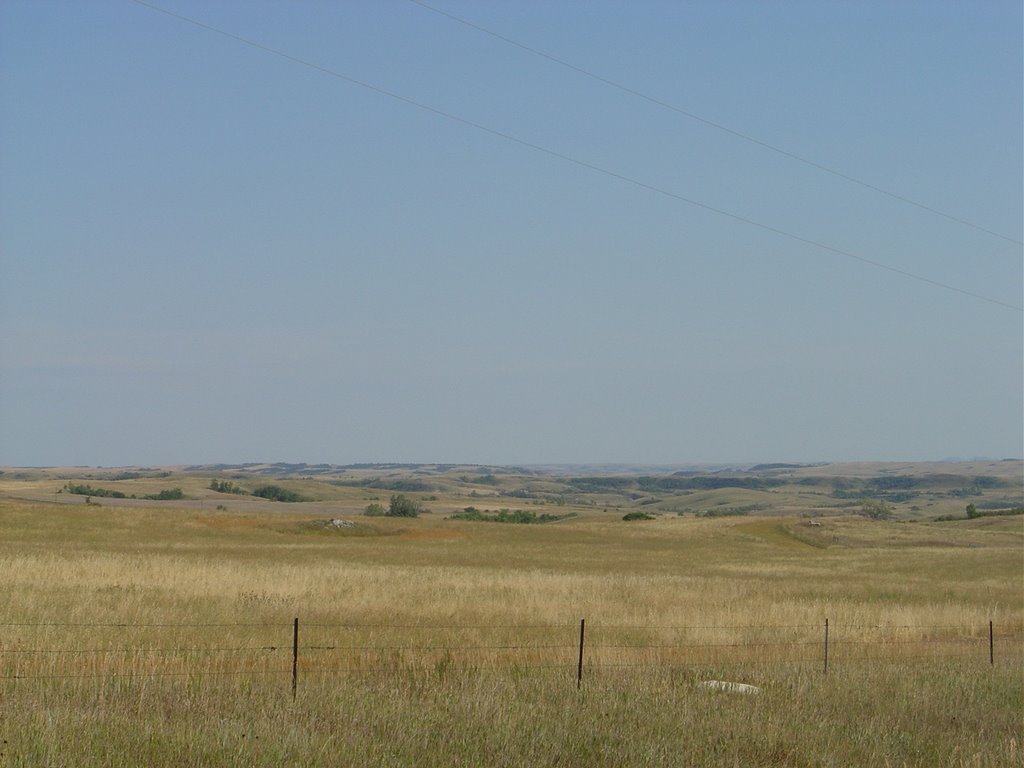
 I'm now way north, and near nothing. Some rusting pickup trucks, some cows, the sun draining down toward an impossibly distant horizon. I head west toward it, and still farther north, until I finally come to US 2, which passes for the main road. More wheat, some hay, sunflowers.
In the late evening I come to a weird, wide lake called Devil's Lake. It's getting cool, threatening rain, the wind is still howling. The waters look cold and deep, but then I look at the landscape around it and realize I might be able to wade across. Mostly, it looks like it doesn't belong here.
I drive on until dark; think about sleeping in the Element at a little rest area and then think better of it. I find a room in the town of Rugby.
Rugby is tourist attraction number 2 in the state of North Dakota: the geographical center of North America. There's a sign that says so:
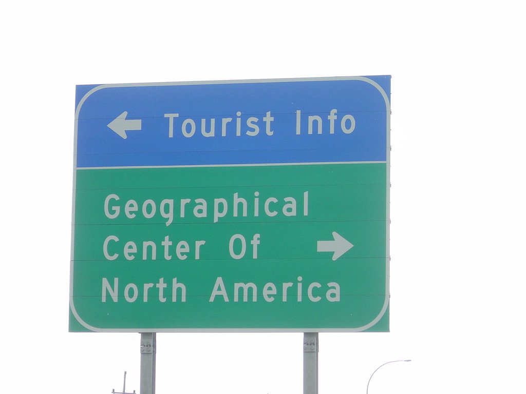
and a pylon in the middle of the parking lot of a building housing a cafe and a gym. A man from Ohio and I share our disappointment in the experience and take each other's picture. I'm fairly certain I got him with his eyes open.

Parked in front of the cafe are mostly pickup trucks with North Dakota plates. I take this to be a good sign, and it basically is. Mostly older men getting together for breakfast on a Saturday morning. I have left the home fries belt and entered the hash browns belt, and this is a good thing, and the waitress asks me if I want them with onions, which makes a good thing better. I pass on the strawberry rhubarb pie, only because I'm full, and on the special "butter gooey cake with coffee, $1," which has nothing to do with my being full.
Thursday, September 07, 2006
NoDak: Tallest
 I take I-94 out of Fargo, since it seems to be the only road going west out of town. After a little while I exit the freeway near Casselton, which means I will miss Jamestown, hometown of the man they know as Pronk, who I think we can safely say is already in his career North Dakota's greatest baseball player. I skip a couple of options in Casselton and opt for lunch at a little cafe in Arthur. I order some sort of a sandwich that comes with fries. Lots of fries. Several potatoes worth of fries.
Arthur, like most of the other towns I pass is a wide spot in the road with a grain elevator. Besides potatoes they have wheat in North Dakota. Lots of wheat.
I keep driving north, and a little west. The roads I drive on get progressively smaller, and even on the main roads, other than I-94, they don't get too many tourists around these parts. Everyone I pass waves to me, and occasionally I remember that they're going to do that and I wave back.
My destination, and I do have one, is the world's tallest structure. This is featured with a red dot on the Rand McNally map of North Dakota, which may give you some sense of how little there is in North Dakota to attract tourists. Or maybe it doesn't: the world's tallest anything probably deserves space on the map regardless of where it is.
But no question, it happens to be in the middle of nowhere. The various websites can't even decide whether it's near Mayville or near Blanchard, but that may simply be because Blanchard, at population 92, doesn't ring bells the way Mayville does with its almost 2,000 residents. It's irrelevant. So far as I can see, there's no one here. There's nothing here. Just me and an orange Element and waving wheat.
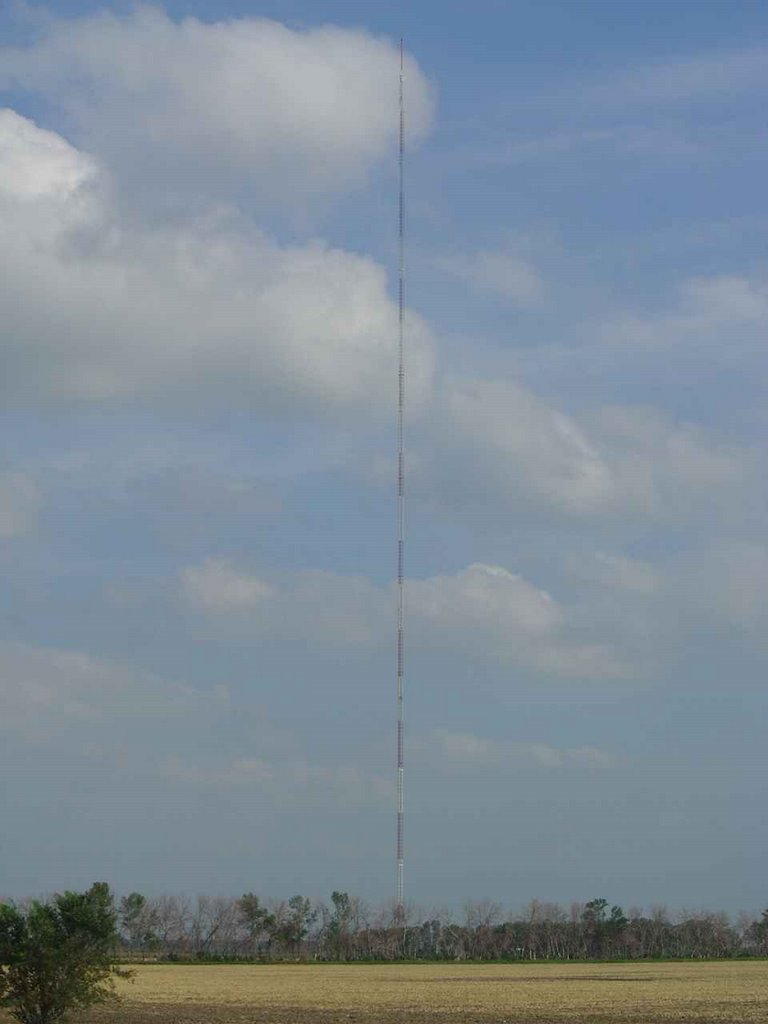 You would think it would be obvious when you're near the world's tallest anything. It's not. For one, it turns out there are a bunch of tall towers here, so it's not immediately clear which is the prize. In fact, the second tallest anything in the world is a few miles away (although I'm not aware of it, since "second tallest" doesn't rate on anybody's map). I peer out the window at one. Is that it? Maybe that? Keep following the map.
For another, there's nothing in the way of signage; nothing that says "world's tallest anything, 2 miles, left at stop."
For a third, there's nothing to give any of these radio masts scale. No buildings. Hardly any trees. Nothing between you and it to tell you how far away it is. Just flat land, wide open sky, wind. They might be tall. I don't know. You drive and drive and don't seem to make much progress toward them, past them.
Finally I get to the intersection of Route 200, head some distance west, see a radio tower down a gravel road and figure my current position best approximates what the map is showing. No sign. I drive down the gravel road a mile or two to a dirt driveway; still no sign. No sign that says "Tallest anything"; no sign that says "Go away." I drive the quarter mile or so up the drive to a little building at the bottom of the mast.
 I look up. Standing next to it is suddenly a whole different experience. Clouds are flying past, and for a moment I'm certain it's falling, or at least swaying uncontrollably. It's an illusion, mostly. The guy cables flex a little in the wind. I trace them, how long they are, and suddenly feel sick to my stomach at the height of the thing. Like I might somehow fall from it standing on the ground.
There's nothing else to see. An elevator that some idiot rides to the top to change the light bulbs. A little sign over the door reading
2063' Tower
Built 1963
is the only thing to confirm that I've come to the right place.

Nobody else has made this drive today. Nobody comes around to ask me if I have any questions, or sell me a keychain, or chase me away.
Saturday, September 02, 2006
North Still
My original intent was to head through South Dakota, across the Badlands to Mount Rushmore and into Wyoming. But I've never been to North Dakota, and I can't imagine when else I might get there. And I'm intrigued by the flat emptiness of the place (this is what happens to you when you grow up in central Ohio, I guess). Someone once told me it's so flat there that you can see the curvature of the earth.
So I head out of Minneapolis going north, without thinking too much about the implications. This route takes me further up the Mississippi, out North Washington Avenue and various nameless streets in various suburbs and crossing over the parking lot that is I-94 during the afternoon rush hour. At Anoka I cross to the northeast side of the river, take some back roads for a while, and then pick up US 10 at St. Cloud.
 The highway takes me north to Little Falls. There are, as I've come to expect, no actual falls at Little Falls, just a small hydro dam and some exposed rock below it. But I stop anyway, mostly to say goodbye to the river. A mile or so north, I cross the Mississippi for the last time on the way west, and light out for the territory.
I cross most of western Minnesota in the dark. In Motley there's a little cafe by the highway that's still open. I order the walleye. They drink coffee with their dinner here, so that's what I have.
Further on, I pass various signs for various minor attractions, mostly fishing and hunting related. Eventually I pull into Moorhead, the last stop in the state.
There's not much kicking in Moorhead at midnight on a Thursday. There is a gay bar, which my research indicates is the only gay bar between Minneapolis and somewhere in Montana. Ye gods. If it were karaoke night I'd probably check it out. But it's not, and I'm not enticed by the possibility of nursing a beer while the regulars wonder who the hell the new guy is. So it's the Travelodge instead.
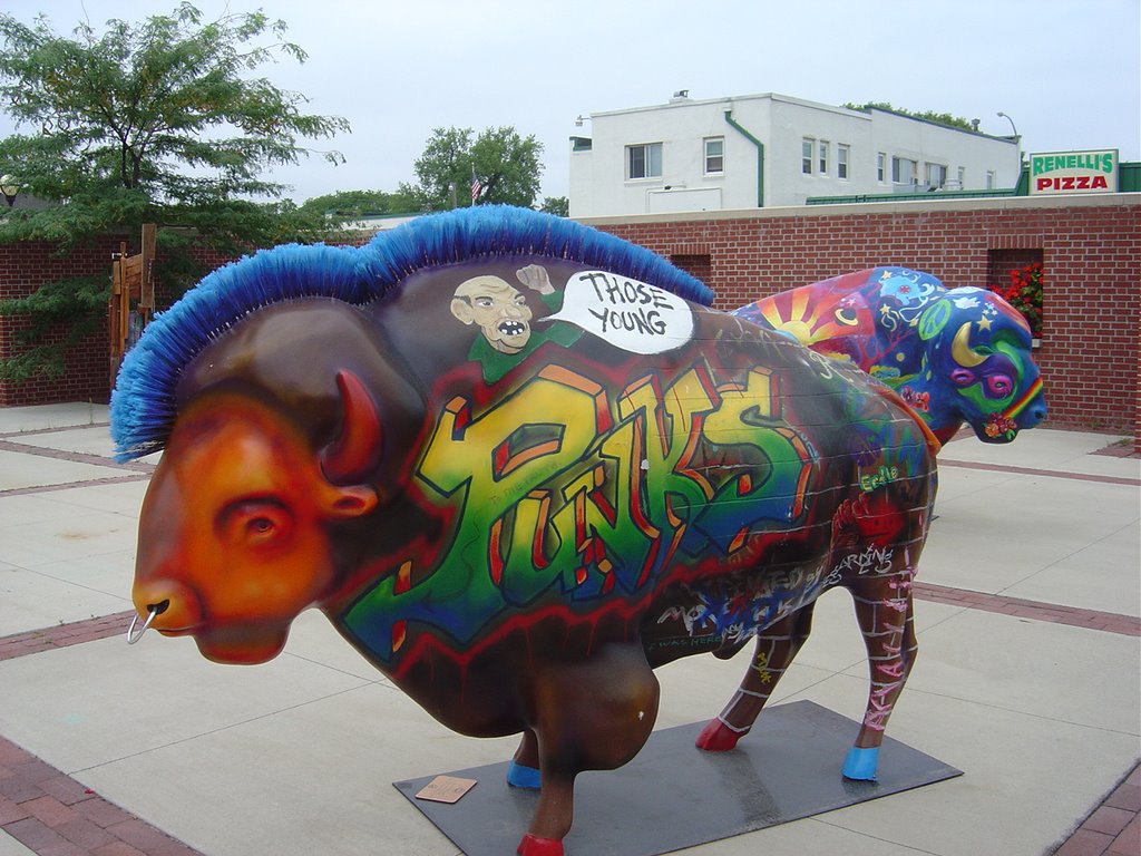
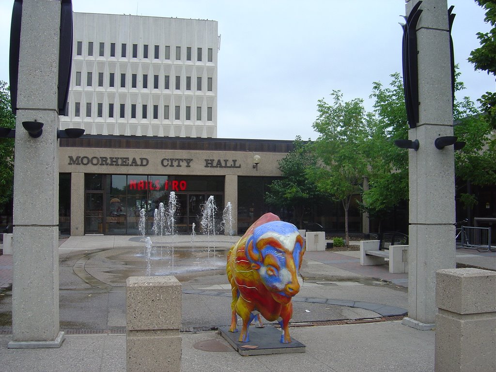
 There's not that much kicking in Moorhead on a Friday morning either. There's a university, but if it's in session it's not generating much activity. There's an art museum that claims to have a pop art exhibit going on. When I walk in the man at the desk looks completely startled to see me, and I'm a bit worried that I might be the only person ever to walk into the art museum in Moorhead, but it turns out they're just closed and forgot to lock the door. I have to content myself with the buffalo outside. (Louisville has horses; other places have cows; Moorhead has buffalo. Or possibly bison.)
There's another one in front of City Hall. Note that City Hall seems to include a nail salon.

I also see this. You thought Garrison Keillor made this stuff up.

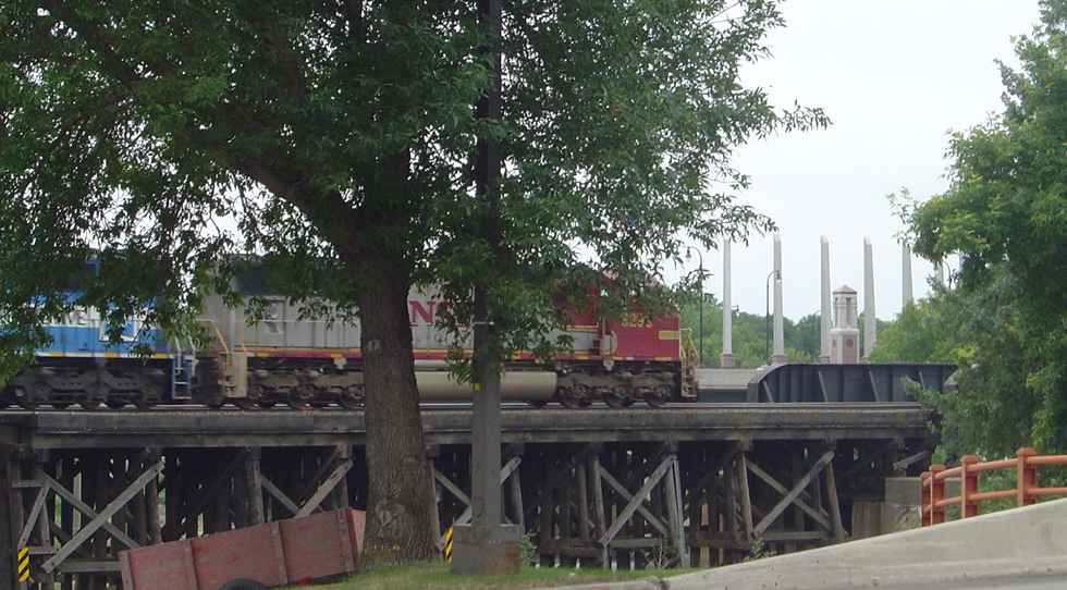
 Moorhead is here because it's where the Northern Pacific Railroad ran into the Red River - or as it's formally called, the Red River of the North. It's now the Burlington Northern Santa Fe, and it runs frequently across a trestle that looks only partly improved since 1887.
I sit in the Atomic Cafe, next to the tracks, and blog and check e-mail, via which my cousin Aura informs me "Do Not Panic." They have my cellphone. They're sending it on to the next stop, Missoula. Which pretty well settles my plans, I guess.
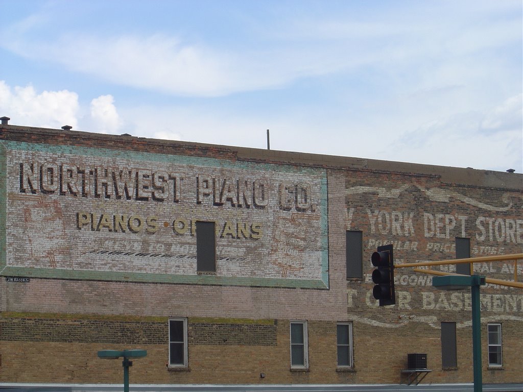
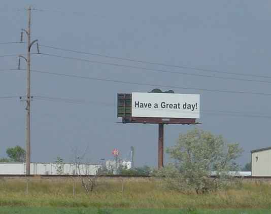
 Across the river is Fargo. I cross the bridge, and the Episcopal Church welcomes me to North Dakota. I can see nothing in Fargo to entice me to stop. There's a sad looking downtown followed by a long string of strip malls on flat plains under a blinding sun. It's the last place you'd ever want to set a movie. (In fact, there don't even seem to be filming locations to go see.)
But at least they want me to have a Great day.

So I head out of Minneapolis going north, without thinking too much about the implications. This route takes me further up the Mississippi, out North Washington Avenue and various nameless streets in various suburbs and crossing over the parking lot that is I-94 during the afternoon rush hour. At Anoka I cross to the northeast side of the river, take some back roads for a while, and then pick up US 10 at St. Cloud.
 The highway takes me north to Little Falls. There are, as I've come to expect, no actual falls at Little Falls, just a small hydro dam and some exposed rock below it. But I stop anyway, mostly to say goodbye to the river. A mile or so north, I cross the Mississippi for the last time on the way west, and light out for the territory.
I cross most of western Minnesota in the dark. In Motley there's a little cafe by the highway that's still open. I order the walleye. They drink coffee with their dinner here, so that's what I have.
Further on, I pass various signs for various minor attractions, mostly fishing and hunting related. Eventually I pull into Moorhead, the last stop in the state.
There's not much kicking in Moorhead at midnight on a Thursday. There is a gay bar, which my research indicates is the only gay bar between Minneapolis and somewhere in Montana. Ye gods. If it were karaoke night I'd probably check it out. But it's not, and I'm not enticed by the possibility of nursing a beer while the regulars wonder who the hell the new guy is. So it's the Travelodge instead.
 There's not that much kicking in Moorhead on a Friday morning either. There's a university, but if it's in session it's not generating much activity. There's an art museum that claims to have a pop art exhibit going on. When I walk in the man at the desk looks completely startled to see me, and I'm a bit worried that I might be the only person ever to walk into the art museum in Moorhead, but it turns out they're just closed and forgot to lock the door. I have to content myself with the buffalo outside. (Louisville has horses; other places have cows; Moorhead has buffalo. Or possibly bison.)
There's another one in front of City Hall. Note that City Hall seems to include a nail salon.
I also see this. You thought Garrison Keillor made this stuff up.

 Moorhead is here because it's where the Northern Pacific Railroad ran into the Red River - or as it's formally called, the Red River of the North. It's now the Burlington Northern Santa Fe, and it runs frequently across a trestle that looks only partly improved since 1887.
I sit in the Atomic Cafe, next to the tracks, and blog and check e-mail, via which my cousin Aura informs me "Do Not Panic." They have my cellphone. They're sending it on to the next stop, Missoula. Which pretty well settles my plans, I guess.
 Across the river is Fargo. I cross the bridge, and the Episcopal Church welcomes me to North Dakota. I can see nothing in Fargo to entice me to stop. There's a sad looking downtown followed by a long string of strip malls on flat plains under a blinding sun. It's the last place you'd ever want to set a movie. (In fact, there don't even seem to be filming locations to go see.)
But at least they want me to have a Great day.
![]()