Friday, February 02, 2007
Going to the Sun
 There are a couple of routes to Missoula, my destination, from the east side of Glacier. One of them takes me back to my old friend US 2 near Browning and down around the biggest of the mountains. The other one, which I opt for, and which is nominally more direct, goes right up over the continental divide through the middle of the National Park.
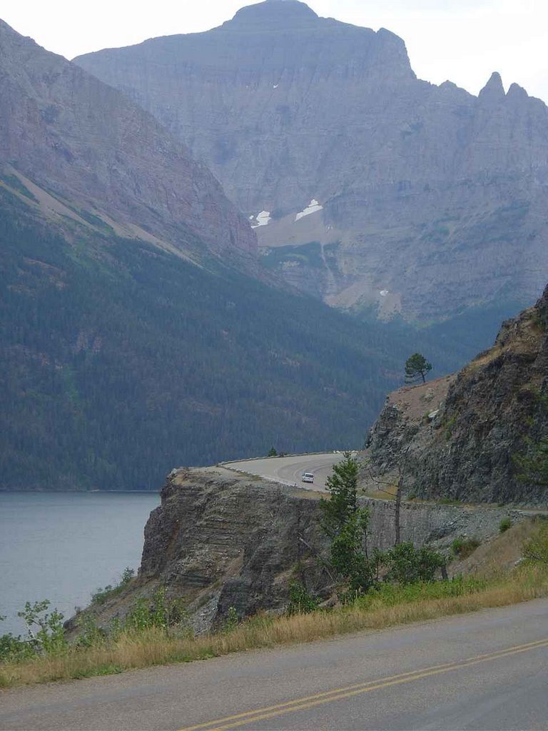
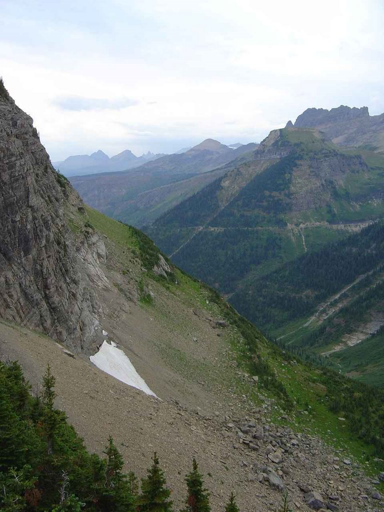
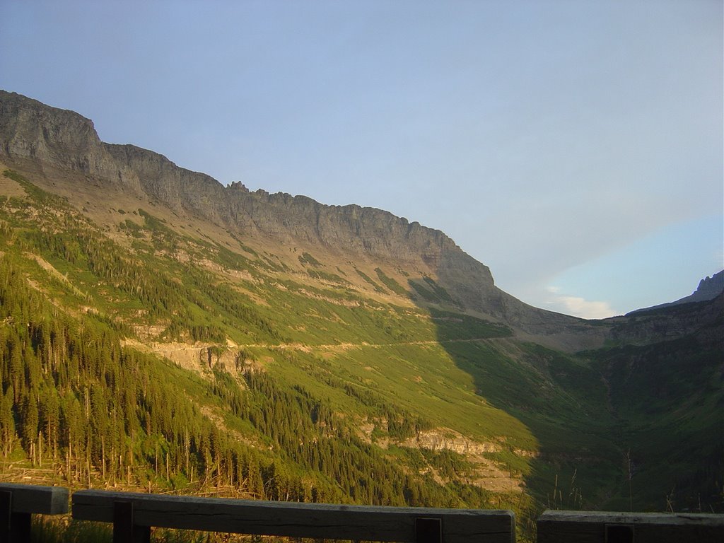
The road is called the "Going-to-the-Sun Road," after the Going-to-the-Sun-Mountain, which may or may not come from a Blackfeet name or at least Blackfeet history. Or maybe not; who knows what to believe? It was built in the twenties and thirties, and was and remains an undeniable feat of engineering: 50 miles up and down and through the sides of mountains.
The 50-mile drive ought to take a full day; a full week, maybe. But I've gotten a late start, of course, thanks to hiking, and huckleberry pie before it, and so here I am with encroaching dark, balancing, as from the beginning, keeping moving against nothing better than this.
The highway starts out by winding along the edge of St. Mary Lake, which I mention mostly in order to correct an egregious geographical error made, and subsequently compounded, in the previous posting. The St. Mary River and its various lakes, and more particularly its tributary Swiftcurrent Creek, do not empty into the Missouri. They flow northerly, instead, through Canada and eventually leading to Hudson Bay. I should have remembered this, or at least considered that the river was unlikely to make the couple-thousand-foot climb over the St. Mary Ridge that the Element and I had made on the way to meeting it.
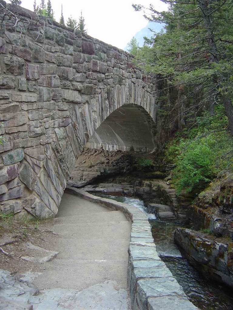
And now I'll shut up for a few moments and let the pictures do the heavy lifting:


Those glaciers, by the way: the National Park Service says they'll be gone by 2030. I'm in no position to say this, having pumped five or six thousand miles worth of carbons into the atmosphere just to get here and take these pictures, and by myself yet. But it might be time to do something.

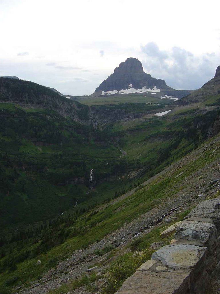
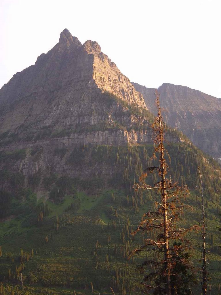
All these mountains have names, but I have no idea which is which, and couldn't possibly figure them out from comparing my pictures to the map. There's a picture of Going-to-the-Sun Mountain here, and maybe you can figure out if I've taken a picture of it.
A couple more going up the east side, including one to indicate what the highway is starting to look like, in case you thought it looked a little prosaic in the earlier photo:


 At the top I reach Logan Pass, elevation 6,646', and the continental divide. And zip right past it, before immediately realizing that this surely represents a landmark on this trip, one of the biggies, on a par with perhaps only with setting out from Brooklyn and crossing the Mississippi. So I prepare to stop and mark the occasion.
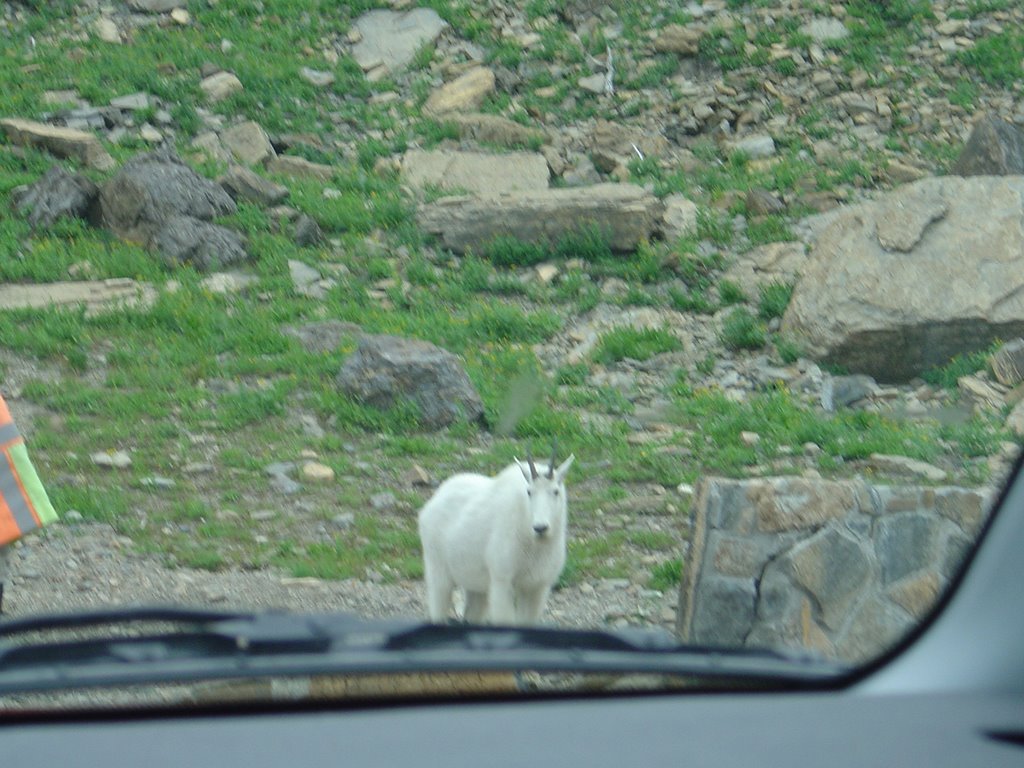
But before doing so, I look up and see that the main reason people are stopping is not the great divide, but a herd of mountain goats blithely wandering around at the side of the road. I won't tell you you can walk right up to them, but you can get pretty close, and kids are running around and screaming pretty much the way I did when encountering that moose. But the goats pretty much mind their own business, like this:

There's another bunch of them across the gap - you can see a few dots representing them in the picture above, just below the big bunch of dark green trees - and at one point a little girl runs up to me and yells, "One of them just jumped all the way from up there to down there - and he didn't die!" And that pretty much sums it up better than I can.
I go back up to the top of the pass and get my picture taken by the sign, and then take a few more so I can show you one that's not disfigured by the guy in the orange jacket:

And then, after a goat dubiously sizes up the Element's mountain-going capabilities ...
... we're on our way down the other side:
 I'm cursing myself at this point for having stayed so long on the Swiftcurrent Trail this morning, because dark is fast approaching, the way it does here, and have neither the desire to miss the scenery nor to test my skills driving this road in the dark, and I'm therefore pressing on, as ever, much faster than I would otherwise choose.
(Which
 isn't all that fast, thanks to both the demands of the highway and the frequency of places to pull off the road and gape. I did stop the car to take this one, by the way.)
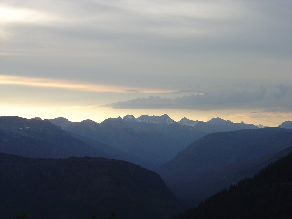 But there were reasons to stay on the trail as long as I did, of course, and it turns out there are rewards to having done so, as well, and whether or not it's what I had been planning on and hoping for, the only sensible course of action is to be delighted at the way things turned out. Which in this case, is that I suddenly find myself driving down the west side of the Logan Pass at the magic hour.
I've lamented my ability to capture the Rockies in the little three-inch by four-inch box I'm carrying around. And these don't come all that close, either. And I claim nothing other than being at the right place at the right time. I'm pretty happy with how they came out, though.


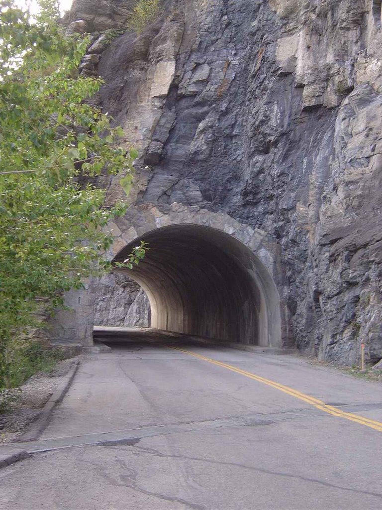
 The road winds by a formation called the Weeping Wall, which by the middle of August is reduced to a few trickles here and there, and around "the loop," and as we dip lower into the valley, which on this side drains into McDonald Creek and Lake McDonald, the fading light fills me with sweet sorrow.
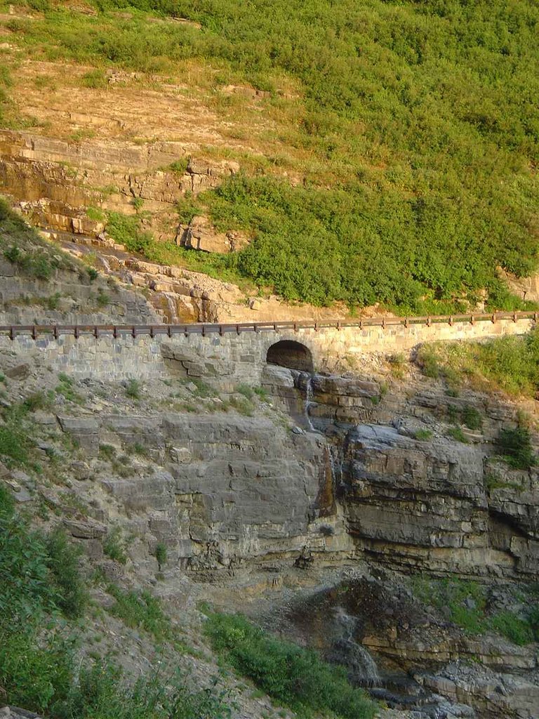
At one point the road travels through a tunnel, and in the middle of the tunnel there's a little doorway they've cut through the rock so you can go out on a ledge and take in the view. I park on the far side of the tunnel and walk back to see what there is to see. It's kind of corny, and I feel dumb stopping to do this, and then dumb and conspicuous when a minivan pulls up and everybody inside piles out to do the same.
 It's an older man with long gray hair and a tie-dye shirt, along with three boys. The oldest of them is about eight, and I take the man to be their grandfather. He speaks softly, and that's the right word: not just quiet but gentle. The kids don't really follow his example, but he keeps patiently pointing things out to them and shepherding them along.
They're looking down over the ledge at some mountain goats, about thirty feet below, and they shout and point and occasionally toss a rock over, while their tie-dyed grandfather patiently tries to calm the shouting and rock-tossing. They point the goats out to me, and I'm happy to be included for a minute. Then I walk over to the other corner of the little terrace, and look down, and see something else moving. I stupidly think it's some sort of a black mountain goat, and call over to the boys "Here, come look at this guy." The words are still coming out of my mouth when I realize it's not a mountain goat but a bear.
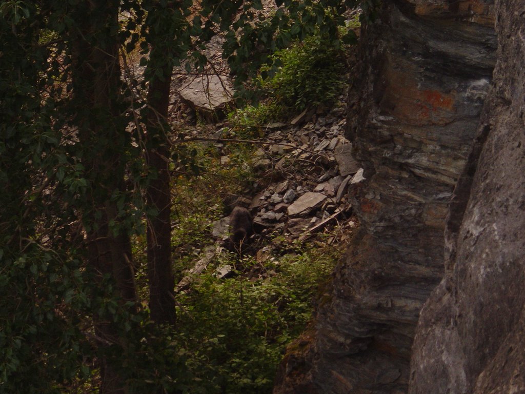 It's hard to get a good view of it - we're thirty feet up, after all, and the light is dim, and the bear doesn't seem to share the mountain goats' unconcern at being looked at. And it's small - so small that I assume it's just a cub, but the man tells me that that's about how big adult black bears are. "Is this your first bear?" the man asks me, and I don't really need to answer.
I take a picture, and the flash scares it back into the trees a bit. We watch a little while longer, and then pile back into our respective cars, and spend the next half-hour or so playing leapfrog down the rest of the road with darkness falling all about us.
It's night by the time I get to the little village at the upper end of Lake McDonald, where there's a terrible-looking restaurant and a store where I get a crummy little pre-packaged sandwich instead. And a huckleberry cream soda, which almost makes up for the sandwich. I find a phone and leave a message for Dave to tell him I won't be making it to Missoula tonight, and it's a good thing he didn't save a ticket to the Nickel Creek concert for me. And then drive off, along the banks of the lake, under the light of the moon.

![]()