Saturday, August 12, 2006
Big Sky
Lewis and Clark State Park, where I'd meant to camp, turns out to be an uninspiring place: a flat spot on the edge of a man-made lake with few trees and plenty of that cursed wind. I picture my tent blowing about me endlessly in the night. I also look at the map and see how far it is to Missoula. I read a couple of signs about the Lewis and Clark expedition, which I've rejoined after leaving it behind in Louisville, and decide to keep moving.
I feel a little guilty about this, because they're having a big Lewis and Clark weekend at the park. The expedition camped at this spot in April, 1805, on their outward journey, and it was also near here, on August 11, 1806, that Pierre Cruzatte aimed at an elk but hit Meriwether Lewis in the hindquarters instead. They have an annual race at the state park called the "Buttshot Run" to commemorate the event.
The man-made lake is called Lake Sakakawea. Somewhere along the way I stop at a sign that explains why they've chosen to spell it this way. There is some controversy on this point, but I'm inclined to pronounce it like the North Dakotans from now on.
 Anyway: there's hours of daylight ahead, and baseball games on the XM Radio to keep me company. I am not oblivious to the strangeness of being able to hear any game I want to without a hint of static, in a place where the nearest town of any size - Williston - is 50 miles away.
There's a back road that takes me to Williston and back to US 2. These are parts where you fill up if you see a gas station, so I do, but otherwise I can see no reason to stop in Williston. I suppose if you live in Crosby you have a somewhat different take on the matter.
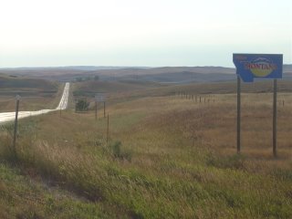
Eventually I come to a sign that welcomes me to Montana. Then I pass a mile marker that informs me it's 665 miles to the next state.
 Montana looks like North Dakota, only bigger. And it earns its nickname: the sky really does look bigger here. And somehow flatter. I spend some time pondering this - I have plenty of time to do so - and conclude that it has to do with the clear air, which enables one to see clouds that are much farther off than the clouds one would see in a humid place like the midwest.
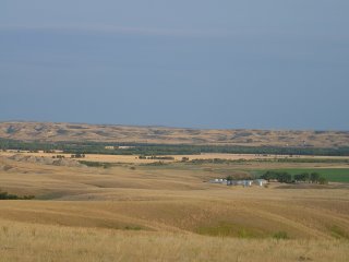
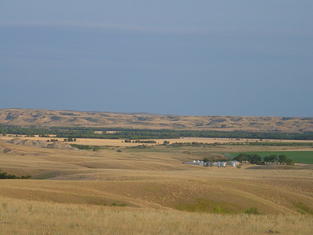
US 2 skirts the bottom of the Fort Peck Indian Reservation. The little towns I pass through are pretty unhappy looking places. Near sundown, I get to Wolf Point, which is a little more lively and has at least three motels I'd consider staying at. I opt for the Big Sky Motel, wondering how many "Big Sky" businesses there are in Montana.
From the room I call my cousin Roslyn, who lives in Missoula but is currently staying with her mom in Browning, Montana. We make arrangements to see each other, or at least to arrange to see each other, since I'm still on that kind of a schedule. She knows where Wolf Point is, which surprises me a little. She refers to US 2 as the "High Line."
The woman in the motel recommends the Elks Club for dinner. I drive by and it's packed, but I'm not sure how it'll work, exactly, eating at the Elks Club, so I pass it. And the frightening Chinese restaurant. By the time I get to the Old Town Grill it's closed. So I get dinner at the Albertsons grocery store. On this Friday night in August it's full of five year olds playing hide-and-seek and teenagers. Judging by the contents of their carts, and they appear to be either battling the munchies or stocking provisions against same.
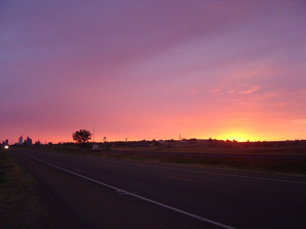
Outside, there's a beautiful sunset and then more stars than you can possibly imagine.

I feel a little guilty about this, because they're having a big Lewis and Clark weekend at the park. The expedition camped at this spot in April, 1805, on their outward journey, and it was also near here, on August 11, 1806, that Pierre Cruzatte aimed at an elk but hit Meriwether Lewis in the hindquarters instead. They have an annual race at the state park called the "Buttshot Run" to commemorate the event.
The man-made lake is called Lake Sakakawea. Somewhere along the way I stop at a sign that explains why they've chosen to spell it this way. There is some controversy on this point, but I'm inclined to pronounce it like the North Dakotans from now on.
 Anyway: there's hours of daylight ahead, and baseball games on the XM Radio to keep me company. I am not oblivious to the strangeness of being able to hear any game I want to without a hint of static, in a place where the nearest town of any size - Williston - is 50 miles away.
 There's a back road that takes me to Williston and back to US 2. These are parts where you fill up if you see a gas station, so I do, but otherwise I can see no reason to stop in Williston. I suppose if you live in Crosby you have a somewhat different take on the matter.
Eventually I come to a sign that welcomes me to Montana. Then I pass a mile marker that informs me it's 665 miles to the next state.
 Montana looks like North Dakota, only bigger. And it earns its nickname: the sky really does look bigger here. And somehow flatter. I spend some time pondering this - I have plenty of time to do so - and conclude that it has to do with the clear air, which enables one to see clouds that are much farther off than the clouds one would see in a humid place like the midwest.
US 2 skirts the bottom of the Fort Peck Indian Reservation. The little towns I pass through are pretty unhappy looking places. Near sundown, I get to Wolf Point, which is a little more lively and has at least three motels I'd consider staying at. I opt for the Big Sky Motel, wondering how many "Big Sky" businesses there are in Montana.
From the room I call my cousin Roslyn, who lives in Missoula but is currently staying with her mom in Browning, Montana. We make arrangements to see each other, or at least to arrange to see each other, since I'm still on that kind of a schedule. She knows where Wolf Point is, which surprises me a little. She refers to US 2 as the "High Line."
The woman in the motel recommends the Elks Club for dinner. I drive by and it's packed, but I'm not sure how it'll work, exactly, eating at the Elks Club, so I pass it. And the frightening Chinese restaurant. By the time I get to the Old Town Grill it's closed. So I get dinner at the Albertsons grocery store. On this Friday night in August it's full of five year olds playing hide-and-seek and teenagers. Judging by the contents of their carts, and they appear to be either battling the munchies or stocking provisions against same.
Outside, there's a beautiful sunset and then more stars than you can possibly imagine.
![]()